Terrafin Mobile 2.5.7 for iPhone and iPad
A Free Weather App
Published By Terrafin Satellite Imaging
Terrafin Mobile (sat.terrafinDist): Terrafin has provided key satellite data online for anglers, divers, and researchers since 1998. Now, Terrafin Mobile gives subscribers easy access...Read More > or Download Now >
Terrafin Mobile for iPhone and iPad
Tech Specs
- • Latest Version: 2.5.7
- • Updated: June 14, 2020
- • Requires: iOS 9.0 and up
- • Developer: Terrafin Satellite Imaging
- • Age Rating: 4+
User Reviews

- • Rating Average
- 3 out of 5
- • Rating Users
- 12
Download Count
- • Total Downloads
- 0
- • Current Version Downloads
- 0
You can download the the latest version of Terrafin Mobile or explore its version history.
More About Terrafin Mobile
Terrafin has provided key satellite data online for anglers, divers, and researchers since 1998. Now, Terrafin Mobile gives subscribers easy access to this data from your iPhone or iPad.
Note: The Terrafin Mobile app installs with an assortment of sample charts, that you can use to try the various features. Access to current data requires an active subscription to the Terrafin website, available @ $109.99/year.
Terrafin Mobile Features:
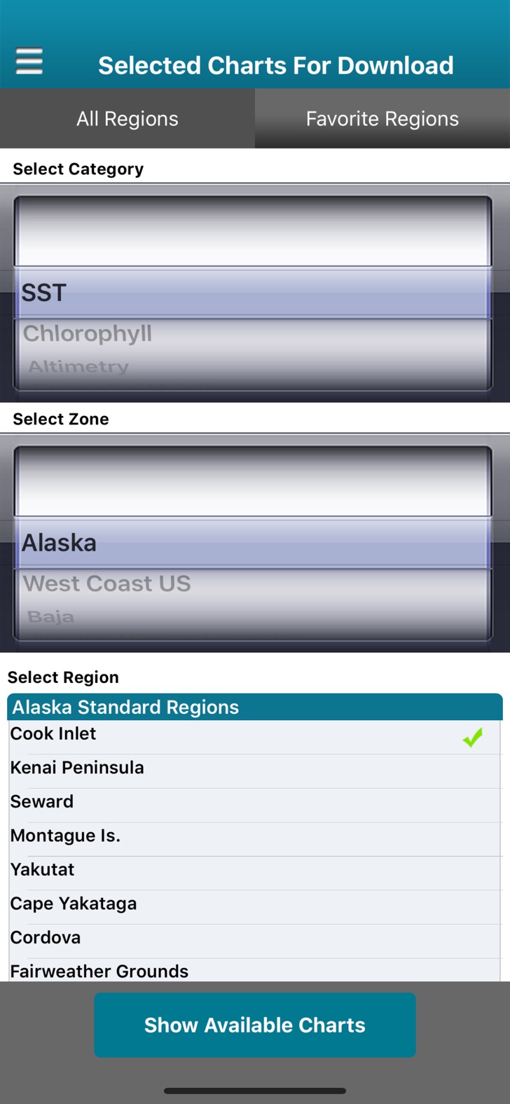
• Browse Terrafin website to easily select charts.
• Charts are downloaded to device for use offline.
• Tap and drag cursor for accurate positioning.
• Latitude / Longitude / Temperature readings at cursor.
• Mark waypoints.
• Distance & Bearing to waypoint or cursor.
• Real time vessel location and track displayed on chart (GPS enabled device required).
Data available with Terrafin Mobile
• Hi Res (1.1km) Sea Surface Temperature Charts, updated 2-3x daily.
• Hi Res (1.1km) Chlorophyll / Ocean Color Charts, updated daily.
• Altimetry (Sea Surface Height) Charts, updated daily.
• Geostrophic Currents Charts, updated daily.
• CloudFree SST charts, updated daily.
Areas of Coverage:
• U.S. East, West, and Gulf Coasts
• Alaska & Hawaii
• Caribbean & Bermuda
• Mexico, including Baja and Sea of Cortez
• Central America (Pacific Coast)
• Venezuela
• Brazil
• Australia East Coast
SAVE FUEL – SAVE $$$ - CATCH MORE FISH!
Note: The Terrafin Mobile app installs with an assortment of sample charts, that you can use to try the various features. Access to current data requires an active subscription to the Terrafin website, available @ $109.99/year.
Terrafin Mobile Features:
• Browse Terrafin website to easily select charts.
• Charts are downloaded to device for use offline.
• Tap and drag cursor for accurate positioning.
• Latitude / Longitude / Temperature readings at cursor.
• Mark waypoints.
• Distance & Bearing to waypoint or cursor.
• Real time vessel location and track displayed on chart (GPS enabled device required).
Data available with Terrafin Mobile
• Hi Res (1.1km) Sea Surface Temperature Charts, updated 2-3x daily.
• Hi Res (1.1km) Chlorophyll / Ocean Color Charts, updated daily.
• Altimetry (Sea Surface Height) Charts, updated daily.
• Geostrophic Currents Charts, updated daily.
• CloudFree SST charts, updated daily.
Areas of Coverage:
• U.S. East, West, and Gulf Coasts
• Alaska & Hawaii
• Caribbean & Bermuda
• Mexico, including Baja and Sea of Cortez
• Central America (Pacific Coast)
• Venezuela
• Brazil
• Australia East Coast
SAVE FUEL – SAVE $$$ - CATCH MORE FISH!
What's New in Terrafin Mobile 2.5.7 >
Bug fixes, corrected login problems on older devices.