ViewRanger (com.augmentra.ViewRangerOpenMaps): Outdoor GPS, Hiking Trail Maps, Record and view all your hikes, Thousands of trails for outdoor adventures....Read More > or Download Now >
ViewRanger for iPhone and iPad
Tech Specs
- • Latest Version: 10.5.15
- • Updated: October 6, 2022
- • Requires: iOS 11.0 and up
- • Developer: Augmentra
- • Age Rating: 4+
User Reviews

- • Rating Average
- 4.5 out of 5
- • Rating Users
- 1629
Download Count
- • Total Downloads
- 63
- • Current Version Downloads
- 16
You can download the the latest version of ViewRanger or explore its version history.
Also ViewRanger is included in the following collections:
More About ViewRanger
Go anywhere too: ViewRanger works offline without mobile and data signals.
*"One of the coolest uses of AR we've seen so far." -Apple *
*"...Must-have gadget for any aspiring hiker." - Red Bull *
*Best New Outdoor Tech –Backpacker *
*Trusted by 400+ Search & Rescue teams *
>MAPS DESIGNED FOR ADVENTURE
Download offline maps onto your phone before you leave home. Then explore off-the-grid, even without cell coverage. ViewRanger offers several map types, including:
*Worldwide Maps: Street maps, aerial and satellite images, and terrain maps.
*Best-in-class topo maps by country: See terrain and trail details other maps miss. The USA Maps bundle includes four map types: USA Topo, USGS Topo, USA Land Cover, and USA Slopes. USA topographic maps zoom down to 1:24k scale in Lower 48 and Hawaii. 1:63k in Alaska.
Exploring outside the US? Check out topographic maps for 23 countries, including Canada, France, Italy, New Zealand, and UK.
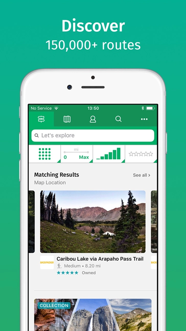
>TRAIL GUIDES
See routes posted by top publishing brands and find trails in national parks, state parks, and national forests. Check out every mile of Appalachian Trail (AT) and Pacific Crest Trail (PCT). Create your own routes on our website too, and follow them on your iPhone.
>ViewRanger PREMIUM
Supercharge the ViewRanger app with top-notch tools and maps to explore the outdoors. The PREMIUM subscription includes:
Skyline AR: Use your device’s camera to identify peaks, places, and other points with augmented reality. See direction arrows and waypoints when following a route.
3D Flyovers: See tracks and routes in amazing 3D. Replay your recorded tracks. Pan and zoom around pre-planned routes.
BuddyBeacon: Safety first. Privately share your real-time location with friends and family. Requires a data connection.
Or, check out our PREMIUM + Map bundles with highly-detailed topographic maps in select countries: UK, USA, France, New Zealand, Canada, Netherlands, and Belgium.
>APPLE WATCH
Download nearby routes directly on your watch. Pan and zoom maps in full screen to view areas in more detail. Follow routes and explore offline on Apple Watch Series 2 3 & 4 (or on earlier models when connected to iPhone).
GPS NAVIGATION & STATS
• See your GPS location on a map
• Record tracks and follow routes
• Plot and go to point of interests
• See live trip and navigation stats: time, speed, distance, navigation arrows, compass bearing, sunrise and sunset.
• Share routes and tracks with friends and social networks
APPLE HEALTH provides detailed information about your activity, including the number of steps you’ve walked and your heart rate (when using Apple Watch™ or Bluetooth 4.0 enabled devices). Tracks recorded from activities in ViewRanger can be saved to Apple Health as workouts.
In-App Subscriptions
We offer a range of auto-renewing subscriptions, including:
Premium, Premium + USA Maps, USA Maps, NRCan Maps for Canada, Premium + Ordnance Survey Maps for Great Britain, Premium + IGN Maps for France.
Prices may vary per country. Prices are clearly displayed in the app.
Subscribe, pay, and manage subscriptions in your iTunes account. Your account will be charged for renewal within 24-hours prior to the end of the current period at the subscription price option you have previously selected. Subscriptions automatically renew unless canceled at least 24 hours before the end of the current period. Refunds not provided for any unused portion of subscription.
Terms of use: my.viewranger.com/page/terms
Privacy policy: my.viewranger.com/page/terms#privacy
What's New in ViewRanger 10.5.15 >
This update includes a small fix to continue supporting the transfer of your account to Outdooractive.
Goodbye from us. We have now switched off access to the ViewRanger app. Thank you to the global community of ViewRanger users who helped make our adventures so much fun.
We recommend you download and use the Outdooractive app instead of ViewRanger. We offer you an easy way to move to the Outdooractive app - where you can continue to access your maps, tracks, routes, POIs, and other ViewRanger app data.
Search for "Outdooractive" and download the app for free.
We'll see you in the Outdooractive community.